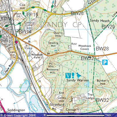
Bridleway 14
Distance:
c.300m. Direction, NNE - SSW
Bridleway
14 starts immediately after crossing the railway bridge north of Sandy Station
(TL 177493) towards Potton. A track follows the railway line north below the towering
68 metre high Sand Hills. You will be following in the footsteps of people who
have climbed these hills for millennia. Palaeolithic peoples from over 20,000
years ago would have used them as a vantage point. Obsidian hand axes from the
Lake District that would have been used to cut down trees and kill animals have
been found within a few kilometres radius. They were uncovered with flints for
cutting skin and meat beside the river Ivel. This area was well-wooded
millennia ago and gradual deforestation has left the countryside generally
denuded. The woods you see are largely pine plantations from late- Victorian
times and the early-20th century.
Just
as you start the walk, you may be able to make out an overgrown sand pit in the
side of the hill. Sand has been exploited in this area for millennia for use in
the construction industry as well as lightening the heavy clay soils. After
about 100 metres the path turns northeast and you begin to ascend the side of
the Greensand Ridge. This is a deposit of coarse-grained sandstone that began
to be laid down over 90 million years ago when Britain was on the same latitude
as the Sahara. The reason for it being called greensand is that it contains
minerals of glauconite, blue-green crystals with a complicated chemical formula
(K0.08 R1.33 R0.67 [Al0.13 S3.87
O10] OH2) that turn green when they are first exposed to
the oxygen in the air. However, after a while they change colour to the dark
brown colour that you will notice when climbing these hills.
At the top of this hill, about 200 metres to the
east, is the site of Iron Age hill fort. The Iron Age people lived after the
Bronze Age from about 500 BC to about 55BC when the Romans started to settle in
Britain. Excavations suggest that it was hastily constructed to act as a
defence against the Roman forces but it did not serve its purpose. The Romans
had settled in this area by the early 1st century and this bridleway
was almost certainly used by them. It follows the western edge of the woods up
a gentle slope up the side of the ridge until it meets footpath
15 (TL 178491).