Footpath 11 (Little Gransden)
Direction W – ENE; Distance c.500m.
![]()
![]()
![]()
![]()
 Footpath
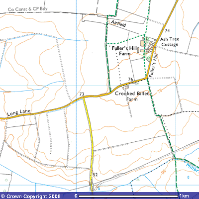
11 starts on the eastern edge of Gamlingay’s parish boundary with Little
Gransden about 500m. west of Fuller’s Hill Farm (263537). It takes you roughly
ENE from Bridleway 6 across three fields
to the north of what were the hangars of Gransden Lodge airfield. The flat land
indicates why the Air Ministry chose this site.
Footpath
11 starts on the eastern edge of Gamlingay’s parish boundary with Little
Gransden about 500m. west of Fuller’s Hill Farm (263537). It takes you roughly
ENE from Bridleway 6 across three fields
to the north of what were the hangars of Gransden Lodge airfield. The flat land
indicates why the Air Ministry chose this site.
The
path is a continuation of what was called Corne Deane on the 1601 map.
It ends where it meets Footpath 10 (Little Gransden) (267535).
![]()