Permitted Footpath
Direction NE -
SW Distance c.200m.
![]()
![]()
![]()
![]()
![]()
![]()
![]()
![]()
![]() This footpath runs through a field marked on Thomas Langdon’s map of 1601 as Broome Close owned by Mrs Brudnell. You
can still see the yellow flowers of the broom in the field to the south. When
the Cloptons field on the eastern side of the brook was sold for development in
the 1960s (?) the residents of the new housing estate of Greenacres got
permission to use the field as a footpath, It is now well used by people walking
their dogs, local children and general walkers.
This footpath runs through a field marked on Thomas Langdon’s map of 1601 as Broome Close owned by Mrs Brudnell. You
can still see the yellow flowers of the broom in the field to the south. When
the Cloptons field on the eastern side of the brook was sold for development in
the 1960s (?) the residents of the new housing estate of Greenacres got
permission to use the field as a footpath, It is now well used by people walking
their dogs, local children and general walkers.
![]() There is
a footpath running north on the eastern side the brook behind the houses and
gardens of Greenacres. After crossing the wooden footbridge across the brook (TL232523)
there are several routes across the field. One goes round the outside and
another up a slight incline across the middle. An isolated tree with
overhanging branches is popular with young climbers. There is a small
depression which may have been where tree roots were removed as several ancient
tree trunks provide a resting place in the middle of the field. An overgrown
copse provides hiding places for young children.
There is
a footpath running north on the eastern side the brook behind the houses and
gardens of Greenacres. After crossing the wooden footbridge across the brook (TL232523)
there are several routes across the field. One goes round the outside and
another up a slight incline across the middle. An isolated tree with
overhanging branches is popular with young climbers. There is a small
depression which may have been where tree roots were removed as several ancient
tree trunks provide a resting place in the middle of the field. An overgrown
copse provides hiding places for young children.
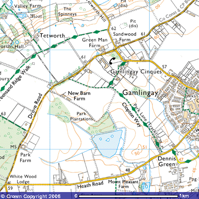
You can often see
horses in Broome Close as there are stables in the smallholding further west.
An electric fence runs along the south side of the field and higher up the
slope a row of giant conifers. The path joins Park Lane
- Footpath 8
at the end (TL 230522), a popular footpath which takes you
roughly north to Gamlingay Cinques and south to